Geolocate

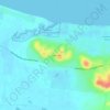
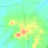
Susan River topographic map

Click on the map to display elevation.

About this map

Name: Susan River topographic map, elevation, terrain.

Location: Susan River, Hervey Bay, Queensland, Australia (-25.45886 152.73267 -25.36609 152.92104)

Average elevation: 14 m

Minimum elevation: -3 m

Maximum elevation: 87 m

Other topographic maps

Click on a map to view its topography, its elevation and its terrain.
Big Woody Island

Australia > Queensland > Hervey Bay

Average elevation: 3 m

Craignish

Australia > Queensland > Hervey Bay

Average elevation: 8 m

Dayman Park

Australia > Queensland > Hervey Bay

Average elevation: 3 m

Booral

Australia > Queensland > Hervey Bay

Average elevation: 27 m

Gear up for your next adventure:

👟Sport Hiking Sandals - Breathable footwear for water crossings and camp rest
🥾Trail Hiking Shoes - Durable shoes designed for rugged trails
🧥Ultralight Puffy Jacket - Maximum warmth that packs down to the size of an orange
🕯️Camping Lantern - Illuminates your entire campsite with high-efficiency LEDs
🥤Collapsible Travel Cup - Saves space and weight in your mess kit

As an Amazon Associate, this site earns from qualifying purchases at no extra cost to you.