
Craignish topographic map
Click on the map to display elevation.
About this map
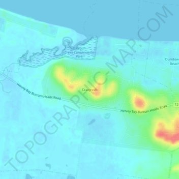
Name: Craignish topographic map, elevation, terrain.
Location: Craignish, Hervey Bay, Queensland, 4655, Australia (-25.29878 152.70671 -25.25878 152.74671)
Average elevation: 8 m
Minimum elevation: -2 m
Maximum elevation: 61 m
Other topographic maps
Click on a map to view its topography, its elevation and its terrain.