
Thank you for supporting this site ❤️
Make a donation
Make a donation
Gear up for your next adventure:
As an Amazon Associate, this site earns from qualifying purchases at no extra cost to you.
Ljungby topographic map
Click on the map to display elevation.
Thank you for supporting this site ❤️
Make a donation
Make a donation
Gear up for your next adventure:
As an Amazon Associate, this site earns from qualifying purchases at no extra cost to you.
About this map
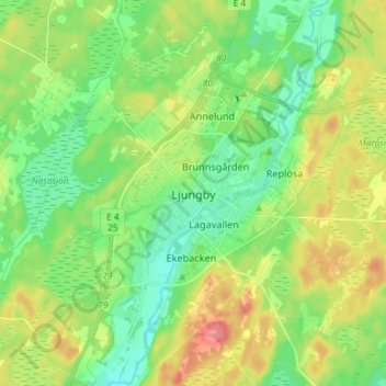
Name: Ljungby topographic map, elevation, terrain.
Location: Ljungby, Ljungby kommun, Kronoberg County, 341 21, Sweden (56.79259 13.89599 56.87259 13.97599)
Average elevation: 153 m
Minimum elevation: 126 m
Maximum elevation: 197 m
Thank you for supporting this site ❤️
Make a donation
Make a donation
Gear up for your next adventure:
As an Amazon Associate, this site earns from qualifying purchases at no extra cost to you.