Geolocate

Montville Township topographic map

Click on the map to display elevation.

About this map

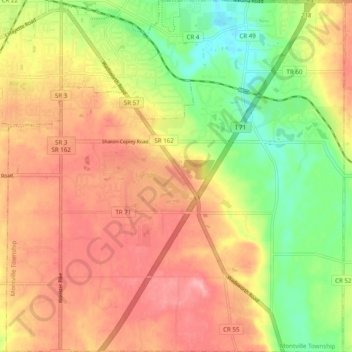
Name: Montville Township topographic map, elevation, terrain.

Location: Montville Township, Medina County, Ohio, United States (41.06227 -81.87944 41.13629 -81.78482)

Average elevation: 341 m

Minimum elevation: 278 m

Maximum elevation: 391 m

Other topographic maps

Click on a map to view its topography, its elevation and its terrain.

Abbeyville

United States > Ohio > Medina County

Average elevation: 278 m

Hinckley

United States > Ohio > Medina County

Average elevation: 330 m

Litchfield

United States > Ohio > Medina County

Average elevation: 306 m

Valley City

United States > Ohio > Medina County

Average elevation: 262 m

Valley City

United States > Ohio > Medina County

Average elevation: 262 m

Valley City

United States > Ohio > Medina County

Average elevation: 262 m

Wadsworth

United States > Ohio > Medina County > Wadsworth

Average elevation: 344 m

Gear up for your next adventure:

🥾Trail Hiking Boots - Supportive boots for rough trails
🥾Trekking Poles - Adjustable trekking poles to reduce knee stress and improve stability
🥫Freeze-Dried Meals - Lightweight, high-calorie nutrition for multi-day treks
🥾Waterproof Hiking Boots - Boots keeping your feet dry in wet conditions
🎒Hiking Backpack - Lightweight and ergonomic backpacks for day hikes or multi-day treks

As an Amazon Associate, this site earns from qualifying purchases at no extra cost to you.