Geolocate

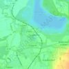
Schraplau topographic map

Click on the map to display elevation.

About this map

Name: Schraplau topographic map, elevation, terrain.

Location: Schraplau, Weida-Land, Saalekreis, Saxony-Anhalt, Germany (51.42026 11.61450 51.45295 11.67816)

Average elevation: 146 m

Minimum elevation: 73 m

Maximum elevation: 195 m

Other topographic maps

Click on a map to view its topography, its elevation and its terrain.

Wassertal

Germany > Saxony-Anhalt > Saalekreis > Schkopau > Knapendorf

Average elevation: 101 m

Luppenau

Germany > Saxony-Anhalt > Saalekreis > Schkopau

Average elevation: 86 m

Drehlitz

Germany > Saxony-Anhalt > Saalekreis

Average elevation: 140 m

Rumpin

Germany > Saxony-Anhalt > Saalekreis > Salzatal

Average elevation: 106 m

Gear up for your next adventure:

🕶️Polarized Sunglasses - Reduces glare from snow and water at high elevations
💧Collapsible Water Bottle - Space-saving water bottle for outdoor activities
🦶Hiking Shoe Insoles - Added support for high arches and long days on feet
🥾Approach Boots - Comfortable boots for hiking and climbing approaches
🧣Merino Neck Gaiter - Protects against wind, sun, and cold at high altitudes

As an Amazon Associate, this site earns from qualifying purchases at no extra cost to you.