Geolocate

Luppenau topographic map

Click on the map to display elevation.

About this map

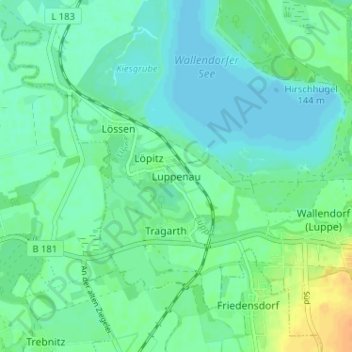
Name: Luppenau topographic map, elevation, terrain.

Location: Luppenau, Schkopau, Saalekreis, Saxony-Anhalt, 06258, Germany (51.34670 12.03000 51.38670 12.07000)

Average elevation: 86 m

Minimum elevation: 77 m

Maximum elevation: 106 m

Gear up for your next adventure:

🦌Outdoor Trail Camera - Monitor wildlife activity near your favorite spots
🐕Hiking Dog Pack - Let your canine companion carry their own water and food
👟Trail Running Shoes - Agile footwear for fast-paced topographic exploration
💧Collapsible Water Bottle - Space-saving water bottle for outdoor activities
🧤Thermal Hiking Gloves - Grip-enhanced gloves for cold-weather altitude trekking

As an Amazon Associate, this site earns from qualifying purchases at no extra cost to you.