Geolocate

Nestow topographic map

Click on the map to display elevation.

About this map

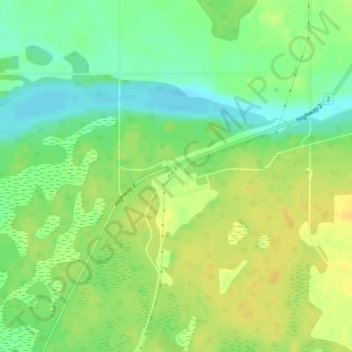
Name: Nestow topographic map, elevation, terrain.

Location: Nestow, Westlock County, Alberta, Canada (54.22878 -113.60293 54.24878 -113.58293)

Average elevation: 634 m

Minimum elevation: 620 m

Maximum elevation: 645 m

Westlock County trails, hiking, mountain biking, running and outdoor activities

Other topographic maps

Click on a map to view its topography, its elevation and its terrain.

Halfway Lake

Canada > Alberta > Westlock County

Average elevation: 631 m

Gear up for your next adventure:

🌡️Emergency Mylar Blankets - Compact thermal protection for unexpected nights outdoors
🧣Evaporative Cooling Towel - Beat the heat during intense summer climbs
🧤Insulated Winter Gloves - Heavy-duty protection for sub-zero Canadian adventures
🥾Mountaineering Boots - Supportive boots for climbing and high-altitude hiking
🧥Ultralight Puffy Jacket - Maximum warmth that packs down to the size of an orange

As an Amazon Associate, this site earns from qualifying purchases at no extra cost to you.