Geolocate

Himley topographic map

Click on the map to display elevation.

About this map

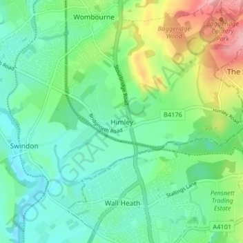
Name: Himley topographic map, elevation, terrain.

Location: Himley, South Staffordshire, Staffordshire, West Midlands, England, DY3 4LB, United Kingdom (52.49798 -2.19716 52.53798 -2.15716)

Average elevation: 96 m

Minimum elevation: 59 m

Maximum elevation: 184 m

Other topographic maps

Click on a map to view its topography, its elevation and its terrain.

Gear up for your next adventure:

🔭Compact Binoculars - Lightweight optics for scouting trails and wildlife
🥾Mountaineering Boots - Supportive boots for climbing and high-altitude hiking
🧳Compression Sacks - Maximize space in your backpack by shrinking gear
🕯️Camping Lantern - Illuminates your entire campsite with high-efficiency LEDs
🧴Sunscreen SPF - Broad-spectrum sunscreen for outdoor activities

As an Amazon Associate, this site earns from qualifying purchases at no extra cost to you.