Geolocate

Mountain View topographic map

Click on the map to display elevation.

About this map

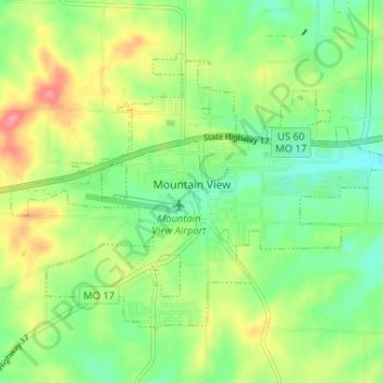
Name: Mountain View topographic map, elevation, terrain.

Location: Mountain View, Howell County, Missouri, United States (36.97552 -91.73461 37.01306 -91.66962)

Average elevation: 362 m

Minimum elevation: 331 m

Maximum elevation: 409 m

Other topographic maps

Click on a map to view its topography, its elevation and its terrain.

Peace Valley

United States > Missouri > Howell County

Average elevation: 322 m

Caulfield

United States > Missouri > Howell County

Average elevation: 309 m

Gear up for your next adventure:

🥾Hiking Leggings - Comfortable leggings for outdoor activities
🔭Compact Monocular - One-handed bird watching and trail spotting
💧Hydration Bladder - Hands-free hydration solution for long treks
🥾Hiking Shoes - Durable and comfortable shoes for trail hiking
🧢Outdoor Visor - Breathable visor for sunny hikes

As an Amazon Associate, this site earns from qualifying purchases at no extra cost to you.