Geolocate

Inhari topographic map

Click on the map to display elevation.

About this map
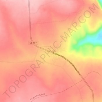
Name: Inhari topographic map, elevation, terrain.

Location: Inhari, Viçosa do Ceará, Ceará, Região Nordeste, Brasil (-3.70139 -41.12349 -3.66139 -41.08349)

Average elevation: 705 m

Minimum elevation: 570 m

Maximum elevation: 746 m

Other topographic maps

Click on a map to view its topography, its elevation and its terrain.

Açude Oiticicas

Brasil > Ceará > Viçosa do Ceará > Lambedouro

Average elevation: 153 m

Lambedouro

Brasil > Ceará > Viçosa do Ceará

Average elevation: 415 m

Pará

Brasil > Ceará > Viçosa do Ceará

Average elevation: 754 m

Gear up for your next adventure:

🧭GPS Outdoor Watch - Smart watch for navigation and fitness tracking in nature
🏕️Camping Hammock - Integrated protection for sleeping between trees
🧤Insulated Winter Gloves - Heavy-duty protection for sub-zero Canadian adventures
🥾Trail Hiking Boots - Supportive boots for rough trails
📷Outdoor Action Camera - Capture high-elevation views and rugged adventures

As an Amazon Associate, this site earns from qualifying purchases at no extra cost to you.