Geolocate

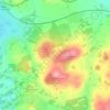
Orrest Head topographic map

Click on the map to display elevation.

About this map

Name: Orrest Head topographic map, elevation, terrain.

Location: Orrest Head, Carriage Drive, Windermere, Westmorland and Furness, England, LA23 1SA, United Kingdom (54.38627 -2.90357 54.38637 -2.90347)

Average elevation: 139 m

Minimum elevation: 40 m

Maximum elevation: 264 m

Other topographic maps

Click on a map to view its topography, its elevation and its terrain.
Gear up for your next adventure:

🧥Packable Rain Jacket - Breathable waterproof layer for unpredictable weather
🧣Evaporative Cooling Towel - Beat the heat during intense summer climbs
🧦Crew Hiking Socks - Comfortable socks for long-distance hikes
🥾Lightweight Hiking Boots - Boots for comfort and mobility on long hikes
🩹Moleskin Blister Pads - Direct protection for painful foot pressure points

As an Amazon Associate, this site earns from qualifying purchases at no extra cost to you.