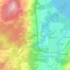
Skurugata topographic map
Click on the map to display elevation.
About this map

Name: Skurugata topographic map, elevation, terrain.
Location: Skurugata, Eksjö kommun, Jönköping County, Sweden (57.68809 15.07060 57.70795 15.09884)
Average elevation: 269 m
Minimum elevation: 214 m
Maximum elevation: 335 m
Other topographic maps
Click on a map to view its topography, its elevation and its terrain.
Jönköping
Jönköping's climate was humid continental (Köppen Dfb) with long, cold winters and short, warm summers during the 1961–1990 period. However, the window between subarctic and oceanic is very small in this marine-influenced climate type, and in recent years the climate has more resembled very cold oceanic.…
Average elevation: 215 m




Jönköping
Between 1961 and 1990, Jönköping's climate was humid continental (Köppen Dfb) with long, cold winters and short, warm summers. However, the window between subarctic and oceanic is very small in this marine-influenced climate type, and in recent years the climate has more resembled very cold oceanic. Figures…
Average elevation: 215 m


Jönköping
Between 1961 and 1990, Jönköping's climate was humid continental (Köppen Dfb) with long, cold winters and short, warm summers. However, the window between subarctic and oceanic is very small in this marine-influenced climate type, and in recent years the climate has more resembled very cold oceanic. Figures…
Average elevation: 215 m