Geolocate

New Inn topographic map

Click on the map to display elevation.

About this map
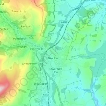
Name: New Inn topographic map, elevation, terrain.

Location: New Inn, Pontypool, Torfaen, Wales, United Kingdom (51.66696 -3.02823 51.72146 -2.96857)

Average elevation: 141 m

Minimum elevation: 38 m

Maximum elevation: 446 m

Other topographic maps

Click on a map to view its topography, its elevation and its terrain.

Pontypool Park

United Kingdom > Wales > Torfaen > Pontypool

Average elevation: 162 m

Gear up for your next adventure:

🧤Rechargeable Heated Gloves - Extreme warmth for Canadian winter expeditions
🥾Hiking Gaiters - Protect legs and shoes from mud, snow, and debris
⛺Lightweight Backpacking Tent - Compact tent for efficient hiking trips
🧶550 Survival Paracord - Versatile utility cord for emergency repairs and rigging
🧥Waterproof Jacket - Lightweight rain jackets for hiking and outdoor activities

As an Amazon Associate, this site earns from qualifying purchases at no extra cost to you.