Geolocate

Middletown topographic map

Click on the map to display elevation.

About this map
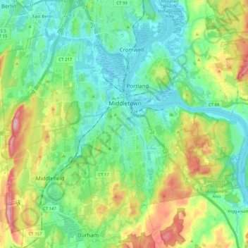
Name: Middletown topographic map, elevation, terrain.

Location: Middletown, Middlesex County, Connecticut, United States (41.49484 -72.75294 41.60432 -72.55095)

Average elevation: 76 m

Minimum elevation: -1 m

Maximum elevation: 262 m

Gear up for your next adventure:

🥫Freeze-Dried Meals - Lightweight, high-calorie nutrition for multi-day treks
🥾Trekking Boots - Durable boots for long-distance trekking
🚲Bike Repair Kit - Essential tools for on-trail mechanical issues
🛁Quick-Dry Microfiber Towel - Space-saving towel that dries rapidly on the move
🧢Outdoor Cap - Protective cap for sun and rain during hikes

As an Amazon Associate, this site earns from qualifying purchases at no extra cost to you.