Geolocate

Thirlmere topographic map

Click on the map to display elevation.

About this map

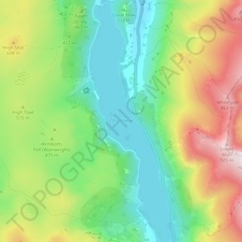
Name: Thirlmere topographic map, elevation, terrain.

Location: Thirlmere, Legburthwaite, Cumberland, England, United Kingdom (54.51001 -3.07576 54.56154 -3.04503)

Average elevation: 446 m

Minimum elevation: 166 m

Maximum elevation: 940 m

Other topographic maps

Click on a map to view its topography, its elevation and its terrain.

Gear up for your next adventure:

🥾Waterproof Hiking Boots - Boots keeping your feet dry in wet conditions
🥾Mountain Trail Shoes - High-traction shoes for mountain trails
🕶️Polarized Sunglasses - Protect your eyes with durable polarized lenses
🥾Approach Shoes - Shoes designed for climbing approaches and rugged trails
🧣Evaporative Cooling Towel - Beat the heat during intense summer climbs

As an Amazon Associate, this site earns from qualifying purchases at no extra cost to you.