Geolocate

Lac Suffolk topographic map

Click on the map to display elevation.

About this map

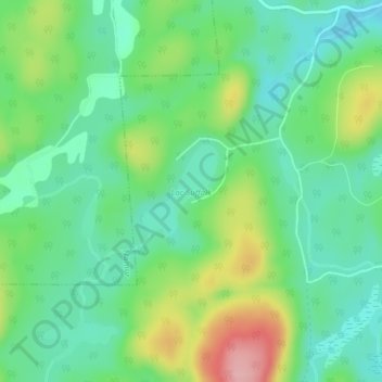
Name: Lac Suffolk topographic map, elevation, terrain.

Location: Lac Suffolk, Boileau, Papineau, Outaouais, Quebec, Canada (45.87238 -74.85980 45.87897 -74.85201)

Average elevation: 269 m

Minimum elevation: 221 m

Maximum elevation: 368 m

Other topographic maps

Click on a map to view its topography, its elevation and its terrain.

Boileau

Canada > Quebec > Papineau > Boileau

Average elevation: 252 m

Gear up for your next adventure:

🎒Backpack Rain Cover - External shield to keep your entire pack dry
🔦UV Flashlight - Detect minerals or specific insects in the dark
🧤Thermal Hiking Gloves - Grip-enhanced gloves for cold-weather altitude trekking
🥾Trail Hiking Shoes - Durable shoes designed for rugged trails
🥾Waterproof Hiking Boots - Essential footwear for rugged terrain and wet Canadian trails

As an Amazon Associate, this site earns from qualifying purchases at no extra cost to you.