
Μεσαγρός topographic map
Interactive map
Click on the map to display elevation.
About this map
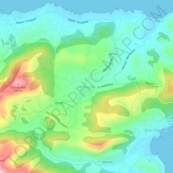
Name: Μεσαγρός topographic map, elevation, terrain.
Location: Μεσαγρός, Δήμος Αίγινας, Îles, Attique, 180 10, Grèce (37.73524 23.49666 37.77524 23.53666)
Average elevation: 90 m
Minimum elevation: -1 m
Maximum elevation: 320 m
Other topographic maps
Click on a map to view its topography, its elevation and its terrain.
Agia Pelagia
Grèce > Attique > Îles > Δημοτική Ενότητα Κυθήρων
Agia Pelagia, Δημοτική Ενότητα Κυθήρων, Δήμος Κυθήρων, Îles, Attique, 802 00, Grèce
Average elevation: 95 m