
Penanggungan topographic map
Interactive map
Click on the map to display elevation.
About this map
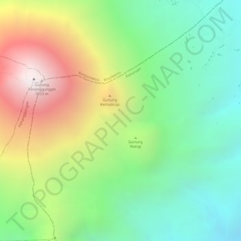
Name: Penanggungan topographic map, elevation, terrain.
Location: Penanggungan, Pasuruan, Jatim, Indonésie (-7.62005 112.62995 -7.61995 112.63005)
Average elevation: 913 m
Minimum elevation: 410 m
Maximum elevation: 1,639 m
Other topographic maps
Click on a map to view its topography, its elevation and its terrain.
Malang Plain
Malang Plain, Malang, Jatim, 65138, Indonésie
Average elevation: 601 m
Gunung Argopuro
Indonésie > Jatim > Probolinggo
Gunung Argopuro, Probolinggo, Jatim, Indonésie
Average elevation: 2,644 m