

Shaw topographic map
Click on the map to display elevation.
Shaw
Described in Samuel Lewis's A Topographical Dictionary of England (1848) as located in "a bleak situation", Shaw and Crompton is in the valley of the River Beal, which runs northward through the town towards the village of Newhey. The land to the east of the town steadily rises, reaching a height of 1,283 feet (391 m) at the summit of Crompton Moor. To the west, the land reaches around 699 feet (213 m) at High Crompton and 825 feet (251 m) at Whitfield, and from these highpoints the surface slopes away in all directions. The River Irk rises on Shaw and Crompton's western boundary with Royton. The geology is represented by carboniferous coal measures. The soils of the town are broadly sterile, the poorest being in the upland moors. Rainfall rises steadily from the Cheshire Plain in a northeasterly direction, and totals are between 51 inches (1,295 mm) to 67 inches (1,702 mm) a year in Shaw and Crompton, which is well above the UK average of 45.4 inches (1,153 mm) and compares to about 33 inches (838 mm) a year at Ringway.
About this map
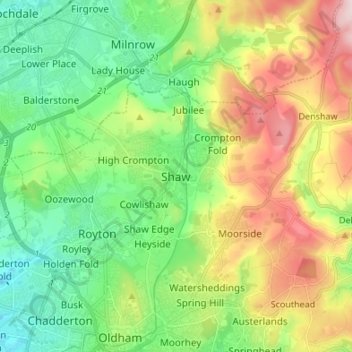
Name: Shaw topographic map, elevation, terrain.
Average elevation: 224 m
Minimum elevation: 103 m
Maximum elevation: 443 m