Geolocate

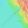
Island Lake topographic map

Click on the map to display elevation.

About this map

Name: Island Lake topographic map, elevation, terrain.

Location: Island Lake, Parry Sound District, Central Ontario, Ontario, Canada (45.74267 -80.30926 45.76521 -80.24745)

Average elevation: 223 m

Minimum elevation: 203 m

Maximum elevation: 237 m

Other topographic maps

Click on a map to view its topography, its elevation and its terrain.

Novar

Canada > Ontario > Parry Sound District > Perry Township

Average elevation: 348 m

Adanac

Canada > Ontario > Parry Sound District > Carling Township

Average elevation: 175 m

Parry Sound

Canada > Ontario > Parry Sound District > Parry Sound

Average elevation: 202 m

Gear up for your next adventure:

🗺️Topographic Maps - Detailed maps to explore trails, mountains, and wilderness areas
🧊Portable Cooler - Keep food and drinks cold during outdoor adventures
🧰Emergency Multi-Tool - Compact multi-tool for outdoor survival
🔥Emergency Fire Starter - Reliable ignition source for all weather conditions
🦯Trekking Poles - Reduced impact on joints for steep topographic climbs

As an Amazon Associate, this site earns from qualifying purchases at no extra cost to you.