Geolocate

Newport topographic map

Click on the map to display elevation.

About this map
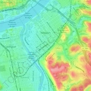
Name: Newport topographic map, elevation, terrain.

Location: Newport, Campbell County, Kentucky, 41071, United States (39.06481 -84.50612 39.10248 -84.46114)

Average elevation: 173 m

Minimum elevation: 136 m

Maximum elevation: 246 m

Gear up for your next adventure:

🥾Waterproof Hiking Shoes - Durable shoes for wet and rugged trails
🧥Fleece Jacket - Warm and lightweight jacket for layering
🪑Ultralight Camping Stool - Compact seating for rest stops during long hikes
🔨Vehicle Emergency Tool - Safety tool for remote road trips to trailheads
🛏️Camping Sleeping Mat - Comfortable mats for sleeping outdoors

As an Amazon Associate, this site earns from qualifying purchases at no extra cost to you.