Geolocate

Everleigh topographic map

Click on the map to display elevation.

About this map

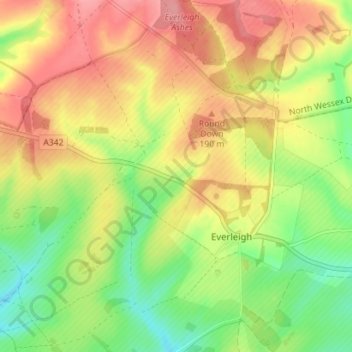
Name: Everleigh topographic map, elevation, terrain.

Location: Everleigh, Wiltshire, England, United Kingdom (51.26686 -1.75128 51.31098 -1.68160)

Average elevation: 167 m

Minimum elevation: 121 m

Maximum elevation: 209 m

Gear up for your next adventure:

🌬️Windproof Camp Stove - Efficient cooking even on exposed mountain peaks
🥾Durable Hiking Shoes - Long-lasting shoes for frequent hiking
👟Leg Gaiters - Keep debris, mud, and snow out of your boots
🔋Solar Power Bank - Keep your GPS and devices charged during long outdoor trips
🧦Merino Wool Socks - Moisture-wicking comfort for long-distance hiking

As an Amazon Associate, this site earns from qualifying purchases at no extra cost to you.