Geolocate

Black Burn topographic map

Click on the map to display elevation.

About this map

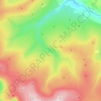
Name: Black Burn topographic map, elevation, terrain.

Location: Black Burn, Eden District, Cumbria, England, CA9 3BU, United Kingdom (54.71068 -2.49336 54.78704 -2.44616)

Average elevation: 528 m

Minimum elevation: 293 m

Maximum elevation: 798 m

Other topographic maps

Click on a map to view its topography, its elevation and its terrain.

Black Dub

United Kingdom > England > Cumbria > Eden District

Average elevation: 727 m

Smardale

United Kingdom > England > Cumbria > Eden District > Waitby > Smardale

Average elevation: 247 m

Dufton Pike

United Kingdom > England > Cumbria > Eden District

Dufton Pike is a hill in the northern Pennines, in Cumbria, England. It is classed as a Marilyn (a hill with topographic prominence of at least 150m). It rises above the village of Dufton.

Average elevation: 313 m

Knock Pike

United Kingdom > England > Cumbria > Eden District

Average elevation: 288 m

Bampton Grange

United Kingdom > England > Cumbria > Eden District

Average elevation: 243 m

High Hesket

United Kingdom > England > Cumbria > Eden District

Average elevation: 127 m

Knock

United Kingdom > England > Cumbria > Eden District

Average elevation: 227 m

Longdale

United Kingdom > England > Cumbria > Eden District

Average elevation: 254 m

Hugh Seat

United Kingdom > England > Cumbria > Eden District

Average elevation: 603 m

Gear up for your next adventure:

💡LED Camping Lantern - Illuminate your campsite with long-lasting lanterns
🥾Waterproof Hiking Shoes - Durable shoes for wet and rugged trails
🏕️Camping Hammock - Integrated protection for sleeping between trees
🧣Evaporative Cooling Towel - Beat the heat during intense summer climbs
🥾Approach Boots - Comfortable boots for hiking and climbing approaches

As an Amazon Associate, this site earns from qualifying purchases at no extra cost to you.