Geolocate

Westerham topographic map

Click on the map to display elevation.

About this map

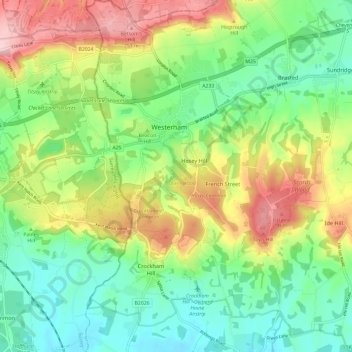
Name: Westerham topographic map, elevation, terrain.

Location: Westerham, Hosey Hill, Sevenoaks, Kent, England, United Kingdom (51.21954 0.04228 51.29402 0.09780)

Average elevation: 134 m

Minimum elevation: 57 m

Maximum elevation: 264 m

Gear up for your next adventure:

🧥Insulated Jacket - Keep warm in cold outdoor conditions
👖Convertible Hiking Pants - Zip-off legs to adapt to changing weather conditions
🛶Kayak Dry Bag - Waterproof storage for kayaking adventures
🧴Outdoor Sunscreen - High SPF protection for high-altitude UV exposure
🎒Fully Waterproof Backpack - Total protection for photography gear and electronics

As an Amazon Associate, this site earns from qualifying purchases at no extra cost to you.