Geolocate

Le Bouchet topographic map

Click on the map to display elevation.

About this map
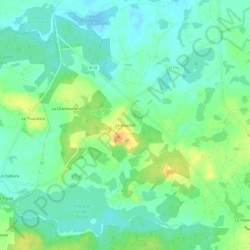
Name: Le Bouchet topographic map, elevation, terrain.

Location: Le Bouchet, Rosnay, Le Blanc, Indre, Centre-Val de Loire, France métropolitaine, 36300, France (46.70093 1.15447 46.74093 1.19447)

Average elevation: 101 m

Minimum elevation: 88 m

Maximum elevation: 126 m

Other topographic maps

Click on a map to view its topography, its elevation and its terrain.
Château du Bouchet

France > Centre-Val de Loire > Indre > Rosnay

Average elevation: 103 m

Gear up for your next adventure:

🥤Collapsible Travel Cup - Saves space and weight in your mess kit
🧳Compression Sacks - Maximize space in your backpack by shrinking gear
🥾Durable Hiking Shoes - Long-lasting shoes for frequent hiking
🔦UV Flashlight - Detect minerals or specific insects in the dark
🧢Outdoor Visor - Breathable visor for sunny hikes

As an Amazon Associate, this site earns from qualifying purchases at no extra cost to you.