Geolocate

Liverpool topographic map

Click on the map to display elevation.

About this map

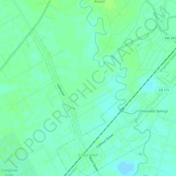
Name: Liverpool topographic map, elevation, terrain.

Location: Liverpool, Brazoria County, Texas, 77577, United States (29.29020 -95.29378 29.32933 -95.25115)

Average elevation: 8 m

Minimum elevation: 3 m

Maximum elevation: 12 m

Other topographic maps

Click on a map to view its topography, its elevation and its terrain.

Damon

United States > Texas > Brazoria County

Average elevation: 25 m

Rosharon

United States > Texas > Brazoria County

Average elevation: 16 m

Meridiana

United States > Texas > Brazoria County > Iowa Colony

Average elevation: 16 m

Damon Mound

United States > Texas > Brazoria County > Damon

Average elevation: 28 m

Rosharon

United States > Texas > Brazoria County

Average elevation: 16 m

Damon

United States > Texas > Brazoria County

Average elevation: 25 m

Gear up for your next adventure:

🕯️Camping Lantern - Illuminates your entire campsite with high-efficiency LEDs
🚲Heavy Duty Bike Lock - Secure your bike at the trailhead or during stops
Backpacking Tent - Lightweight tent for long-distance hiking trips
🥾Trail Running Shoes - Lightweight and durable shoes for trail running
Camping Tent - Weather-resistant tents suitable for 2 to 6 people

As an Amazon Associate, this site earns from qualifying purchases at no extra cost to you.