Geolocate

Leersum topographic map

Click on the map to display elevation.

About this map

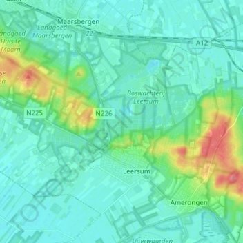
Name: Leersum topographic map, elevation, terrain.

Location: Leersum, Utrechtse Heuvelrug, Utrecht, Netherlands (51.99535 5.36362 52.05624 5.48757)

Average elevation: 15 m

Minimum elevation: 1 m

Maximum elevation: 72 m

Other topographic maps

Click on a map to view its topography, its elevation and its terrain.

Amersfoortse Berg

Netherlands > Utrecht > Amersfoort

Average elevation: 19 m

Cabauw

Netherlands > Utrecht

Average elevation: -1 m

Palestina

Netherlands > Utrecht > Amersfoort

Average elevation: 2 m

Breedeveen

Netherlands > Utrecht > Leersum

Average elevation: 15 m

Amerongse Berg

Netherlands > Utrecht > Amerongen

Average elevation: 34 m

Eembrugge

Netherlands > Utrecht > Baarn

Average elevation: 1 m

Graaf

Netherlands > Utrecht > Lopik

Average elevation: 0 m

Gear up for your next adventure:

🧦Outdoor Socks - Durable socks designed for hiking and outdoor sports
🔨Vehicle Emergency Tool - Safety tool for remote road trips to trailheads
🔭Compact Binoculars - Lightweight optics for scouting trails and wildlife
🧴Sunscreen SPF - Broad-spectrum sunscreen for outdoor activities
🚲Handlebar Phone Mount - View topographic-map.com live while cycling

As an Amazon Associate, this site earns from qualifying purchases at no extra cost to you.