Geolocate

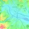
Piavets topographic map

Click on the map to display elevation.

About this map

Name: Piavets topographic map, elevation, terrain.

Location: Piavets, Momchilgrad, Kardzhali, 6818, Bulgaria (41.47547 25.43495 41.51547 25.47495)

Average elevation: 464 m

Minimum elevation: 277 m

Maximum elevation: 693 m

Other topographic maps

Click on a map to view its topography, its elevation and its terrain.

Arda

Bulgaria > Kardzhali

Average elevation: 396 m

Kardzhali

Bulgaria > Kardzhali

Average elevation: 283 m

Kirkovo

Bulgaria > Kardzhali

Average elevation: 516 m

Gear up for your next adventure:

🥾Mountain Trail Shoes - High-traction shoes for mountain trails
☕Camping Coffee Maker - Brew fresh coffee anywhere on the topographic map
🚲Handlebar Phone Mount - View topographic-map.com live while cycling
🧦Thermal Socks - Warm socks for winter hiking or camping
🧴Bear Spray Holster - Quick-access carry for essential Canadian wilderness safety

As an Amazon Associate, this site earns from qualifying purchases at no extra cost to you.