Geolocate

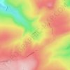
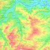
Lane topographic map

Click on the map to display elevation.

About this map

Name: Lane topographic map, elevation, terrain.

Location: Lane, Kirklees, West Yorkshire, England, HD9 2QF, United Kingdom (53.52713 -1.86592 53.56713 -1.82592)

Average elevation: 374 m

Minimum elevation: 175 m

Maximum elevation: 577 m

Other topographic maps

Click on a map to view its topography, its elevation and its terrain.
Meltham

United Kingdom > England > Kirklees

Average elevation: 278 m

Holmfirth Branch

United Kingdom > England > Kirklees > Brockholes

Average elevation: 185 m

Mirfield

United Kingdom > England > Kirklees > Lower Hopton

Average elevation: 97 m

Denby Dale

United Kingdom > England > Kirklees > Scissett

Average elevation: 168 m

Kirkburton

United Kingdom > England > Kirklees

Average elevation: 148 m

Holme Valley

United Kingdom > England > Kirklees > Holmfirth

Average elevation: 290 m

Greenhead Park

United Kingdom > England > Kirklees > Huddersfield

Average elevation: 119 m

Hey Wood

United Kingdom > England > Kirklees > Farnley Tyas

Average elevation: 186 m

Crow Nest Park

United Kingdom > England > Kirklees > Dewsbury

Average elevation: 64 m

Denby Dale

United Kingdom > England > Kirklees

Average elevation: 187 m

Gear up for your next adventure:

🧴Sunscreen SPF - Broad-spectrum sunscreen for outdoor activities
🧢Hiking Sun Hat - Wide-brimmed protection for exposed mountain ridges
🦟Insect Repellent - Keep mosquitoes and black flies away in wooded areas
🧊Insulated Water Bottle - Keeps drinks cold in summer and prevents freezing in winter
🔥Emergency Fire Starter - Reliable ignition source for all weather conditions

As an Amazon Associate, this site earns from qualifying purchases at no extra cost to you.