Geolocate

Totnes topographic map

Click on the map to display elevation.

About this map
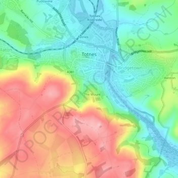
Name: Totnes topographic map, elevation, terrain.

Location: Totnes, Dartington, South Hams, Devon, Devon and Torbay, England, United Kingdom (50.41201 -3.71522 50.44066 -3.66777)

Average elevation: 66 m

Minimum elevation: -4 m

Maximum elevation: 156 m

Other topographic maps

Click on a map to view its topography, its elevation and its terrain.
Week

United Kingdom > England > Devon > South Hams > Dartington

Average elevation: 49 m

Gear up for your next adventure:

🧥Softshell Hiking Jacket - The perfect balance of wind protection and breathability
🧭GPS Handheld Device - Reliable GPS navigation for outdoor adventures
🧦Merino Wool Socks - Moisture-wicking comfort for long-distance hiking
🔦LED Headlamp - Hands-free lighting for early morning starts or late finishes
🎒Hiking Backpack - Lightweight and ergonomic backpacks for day hikes or multi-day treks

As an Amazon Associate, this site earns from qualifying purchases at no extra cost to you.