Geolocate

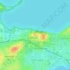
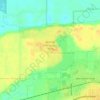
Middleton topographic map

Click on the map to display elevation.

About this map
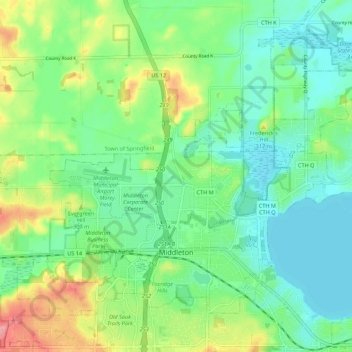
Name: Middleton topographic map, elevation, terrain.

Location: Middleton, Dane County, Wisconsin, 53562, United States (43.08203 -89.56126 43.14478 -89.45210)

Average elevation: 290 m

Minimum elevation: 258 m

Maximum elevation: 361 m

Other topographic maps

Click on a map to view its topography, its elevation and its terrain.

Waunakee Marsh

United States > Wisconsin > Dane County > Waunakee

Average elevation: 292 m

Buss's Corners

United States > Wisconsin > Dane County

Average elevation: 289 m

Burke

United States > Wisconsin > Dane County > Madison

Average elevation: 292 m

Table Bluff

United States > Wisconsin > Dane County

Average elevation: 306 m

Frederick's Hill

United States > Wisconsin > Dane County

Average elevation: 279 m

Stoughton

United States > Wisconsin > Dane County > Stoughton

Average elevation: 270 m

Bowens Addition

United States > Wisconsin > Dane County > Madison

Average elevation: 266 m

East Bristol

United States > Wisconsin > Dane County

Average elevation: 285 m

Marxville

United States > Wisconsin > Dane County > Town of Berry

Average elevation: 300 m

Gear up for your next adventure:

🛌Down Sleeping Bag - Superior warmth-to-weight ratio for cold nights
🥾Lightweight Hiking Boots - Boots for comfort and mobility on long hikes
☕Camping Coffee Maker - Brew fresh coffee anywhere on the topographic map
💡Compact LED Flashlight - Powerful and portable flashlight for outdoor use
🥾Approach Shoes - Shoes designed for climbing approaches and rugged trails

As an Amazon Associate, this site earns from qualifying purchases at no extra cost to you.