
Wangunharja topographic map
Interactive map
Click on the map to display elevation.
About this map
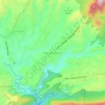
Name: Wangunharja topographic map, elevation, terrain.
Average elevation: 1,230 m
Minimum elevation: 1,014 m
Maximum elevation: 1,560 m
Other topographic maps
Click on a map to view its topography, its elevation and its terrain.
02
Indonésie > Java occidental > Bandung Barat > Wangunharja
02, Wangunharja, Bandung Barat, Java occidental, Indonésie
Average elevation: 1,197 m
Cikole
Indonésie > Java occidental > Bandung Barat
Cikole, Bandung Barat, Java occidental, Jawa, 40931, Indonésie
Average elevation: 1,232 m