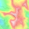
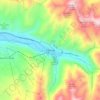
Blue Lake topographic map
Click on the map to display elevation.
About this map

Name: Blue Lake topographic map, elevation, terrain.
Location: Blue Lake, San Miguel County, Colorado, United States (37.88552 -107.76581 37.89138 -107.76115)
Average elevation: 3,823 m
Minimum elevation: 3,471 m
Maximum elevation: 4,103 m
Other topographic maps
Click on a map to view its topography, its elevation and its terrain.
Telluride
United States > Colorado > San Miguel County
Telluride has an elevation of 8,750 feet (2,670 m) in an isolated spot in Southwest Colorado. From the west, Colorado Route 145 is the most common way into Telluride; two other passes enter the town, Imogene Pass and Black Bear Pass.
Average elevation: 3,125 m
Telluride
United States > Colorado > San Miguel County
Telluride has an elevation of 8,750 feet (2,670 m) in an isolated spot in Southwest Colorado. From the west, Colorado Route 145 is the most common way into Telluride; two other passes enter the town, Imogene Pass and Black Bear Pass.
Average elevation: 3,125 m
Telluride
United States > Colorado > San Miguel County
Telluride has an elevation of 8,750 feet (2,670 m) in an isolated spot in Southwest Colorado. From the west, Colorado Route 145 is the most common way into Telluride; two other passes enter the town, Imogene Pass and Black Bear Pass.
Average elevation: 3,125 m

Telluride
United States > Colorado > San Miguel County > Telluride
Telluride has an elevation of 8,750 feet (2,670 m) in an isolated spot in Southwest Colorado. From the west, Colorado Route 145 is the most common way into Telluride; two other passes enter the town, Imogene Pass and Black Bear Pass.
Average elevation: 3,246 m