Geolocate

Harspelt topographic map

Click on the map to display elevation.

About this map
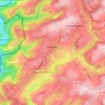
Name: Harspelt topographic map, elevation, terrain.

Location: Harspelt, Arzfeld, Eifelkreis Bitburg-Prüm, Rijnland-Palts, Duitsland (50.12058 6.13834 50.15109 6.20656)

Average elevation: 470 m

Minimum elevation: 318 m

Maximum elevation: 540 m

Other topographic maps

Click on a map to view its topography, its elevation and its terrain.

Gear up for your next adventure:

🌬️Windproof Camp Stove - Efficient cooking even on exposed mountain peaks
🎒Hiking Daypack - Lightweight and durable backpacks for day trips and excursions
🚑Survival Whistle - Signal for help across long distances in mountains
🕶️Polarized Sunglasses - Reduces glare from snow and water at high elevations
🌡️Emergency Mylar Blankets - Compact thermal protection for unexpected nights outdoors

As an Amazon Associate, this site earns from qualifying purchases at no extra cost to you.