
Storasund topographic map
Click on the map to display elevation.
About this map
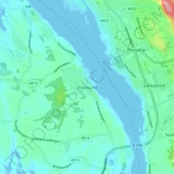
Name: Storasund topographic map, elevation, terrain.
Location: Storasund, Karmøy, Rogaland, 4260, Norway (59.36885 5.25370 59.40885 5.29370)
Average elevation: 20 m
Minimum elevation: -1 m
Maximum elevation: 139 m
Other topographic maps
Click on a map to view its topography, its elevation and its terrain.