Geolocate

Sandy topographic map

Click on the map to display elevation.

About this map
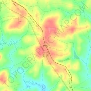
Name: Sandy topographic map, elevation, terrain.

Location: Sandy, Butts County, Georgia, 30216, United States (33.21512 -83.89629 33.25512 -83.85629)

Average elevation: 164 m

Minimum elevation: 126 m

Maximum elevation: 201 m

Gear up for your next adventure:

🌬️Windproof Camp Stove - Efficient cooking even on exposed mountain peaks
⛺Family Camping Tent - Spacious tent suitable for family camping trips
💧Hydration Bladder - Hands-free hydration solution for long treks
🧰Survival Kit - Essential gear for emergencies in the wilderness
🔋Solar Power Bank - Keep your GPS and devices charged during long outdoor trips

As an Amazon Associate, this site earns from qualifying purchases at no extra cost to you.