Geolocate

Sites topographic map

Click on the map to display elevation.

Sites

Sites is an unincorporated community in Colusa County, California, United States. It lies at an elevation of 299 feet (91 m). Its ZIP code is 95979 and its area code is 530.

Wikipedia (CC-BY-SA 3.0)

About this map

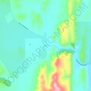
Name: Sites topographic map, elevation, terrain.

Location: Sites, Colusa County, California, United States (39.28878 -122.35859 39.32878 -122.31859)

Average elevation: 131 m

Minimum elevation: 63 m

Maximum elevation: 359 m

Other topographic maps

Click on a map to view its topography, its elevation and its terrain.

Williams

United States > California > Colusa County

Average elevation: 26 m

Gear up for your next adventure:

🥾Lightweight Hiking Shoes - Comfortable shoes for day hikes
🥾Mountaineering Boots - Supportive boots for climbing and high-altitude hiking
🥾Hiking Shoes - Durable and comfortable shoes for trail hiking
💡LED Headlamp - Hands-free illumination for night hiking and camping
🔭Outdoor Binoculars - Lightweight binoculars for birdwatching and hiking

As an Amazon Associate, this site earns from qualifying purchases at no extra cost to you.