Geolocate

Lothian topographic map

Click on the map to display elevation.

About this map

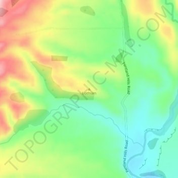
Name: Lothian topographic map, elevation, terrain.

Location: Lothian, Waimate District, Canterbury, New Zealand (-44.67824 170.79262 -44.67814 170.79272)

Average elevation: 377 m

Minimum elevation: 300 m

Maximum elevation: 490 m

Other topographic maps

Click on a map to view its topography, its elevation and its terrain.

Gear up for your next adventure:

🥾Trail Hiking Boots - Supportive boots for rough trails
Camping Essentials - All-in-one gear for a comfortable camping trip
🔭Outdoor Binoculars - Lightweight binoculars for birdwatching and hiking
🦯Trekking Poles - Reduced impact on joints for steep topographic climbs
🗺️Topographic Maps - Detailed maps to explore trails, mountains, and wilderness areas

As an Amazon Associate, this site earns from qualifying purchases at no extra cost to you.