Geolocate

Olds topographic map

Click on the map to display elevation.

About this map

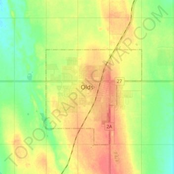
Name: Olds topographic map, elevation, terrain.

Location: Olds, Town of Olds, Alberta, T4H 1H7, Canada (51.75237 -114.15304 51.83237 -114.07304)

Average elevation: 1,027 m

Minimum elevation: 1,003 m

Maximum elevation: 1,052 m

Town of Olds trails, hiking, mountain biking, running and outdoor activities

Gear up for your next adventure:

🧢Outdoor Cap - Protective cap for sun and rain during hikes
🦶Anti-Blister Balm - Prevents friction and hotspots during long ascents
🧼Biodegradable Camp Soap - Environmentally friendly cleaning for gear and body
🧥Waterproof Jacket - Lightweight rain jackets for hiking and outdoor activities
🧢Sun Protection Cap - Breathable cap to protect from sun exposure

As an Amazon Associate, this site earns from qualifying purchases at no extra cost to you.