Geolocate

Ceggia topographic map

Click on the map to display elevation.

About this map

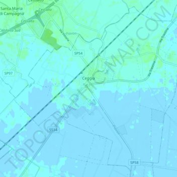
Name: Ceggia topographic map, elevation, terrain.

Location: Ceggia, Venezia, Veneto, 30022, Italy (45.65530 12.60173 45.71042 12.68636)

Average elevation: 1 m

Minimum elevation: -3 m

Maximum elevation: 7 m

Other topographic maps

Click on a map to view its topography, its elevation and its terrain.

Lison

Italy > Veneto > Venezia > Portogruaro

Average elevation: 3 m

Lison

Italy > Veneto > Venezia > Portogruaro

Average elevation: 3 m

Canal Grande

Italy > Veneto > Venezia > Venice > Lido

Average elevation: 2 m

Marghera

Italy > Veneto > Venezia > Venice

Average elevation: 4 m

Duna Verde

Italy > Veneto > Venezia > Caorle

Average elevation: -1 m

Burano

Italy > Veneto > Venezia > Venice > Burano

Average elevation: 0 m

Mestre

Italy > Veneto > Venezia > Venice

Average elevation: 4 m

Sandon

Italy > Veneto > Venezia

Average elevation: 4 m

Sandon

Italy > Veneto > Venezia

Average elevation: 4 m

Bibione

Italy > Veneto > Venezia

Average elevation: 0 m

Mestre

Italy > Veneto > Venezia

Average elevation: 5 m

Lido

Italy > Veneto > Venezia > Venice

Average elevation: 0 m

Favaro Veneto

Italy > Veneto > Venezia > Venice > Favaro Veneto

Average elevation: 3 m

Lido di Jesolo

Italy > Veneto > Venezia > Jesolo > Lido di Jesolo

Average elevation: 0 m

Murano

Italy > Veneto > Venezia > Venice

Average elevation: 1 m

Sant'Erasmo

Italy > Veneto > Venezia > Venice > Sant'Erasmo

Average elevation: 0 m

Lido

Italy > Veneto > Venezia > Venice

Average elevation: 0 m

Gear up for your next adventure:

Bushcraft Tarp - Versatile emergency shelter or gear protection
🧥Softshell Jacket - Windproof and breathable jacket for hiking
🥾Durable Hiking Shoes - Long-lasting shoes for frequent hiking
Tent Footprint - Protect tent floor and increase durability
🥾Hiking Shorts - Breathable shorts suitable for summer hikes

As an Amazon Associate, this site earns from qualifying purchases at no extra cost to you.