Geolocate

Coxheath topographic map

Click on the map to display elevation.

About this map
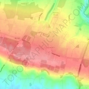
Name: Coxheath topographic map, elevation, terrain.

Location: Coxheath, Maidstone, Kent, England, United Kingdom (51.22614 0.47648 51.24256 0.50943)

Average elevation: 97 m

Minimum elevation: 34 m

Maximum elevation: 134 m

Gear up for your next adventure:

🛏️Camping Sleeping Mat - Comfortable mats for sleeping outdoors
🪑Ultralight Camping Stool - Compact seating for rest stops during long hikes
🧰Emergency Multi-Tool - Compact multi-tool for outdoor survival
🥾Durable Hiking Shoes - Long-lasting shoes for frequent hiking
🧤Insulated Winter Gloves - Heavy-duty protection for sub-zero Canadian adventures

As an Amazon Associate, this site earns from qualifying purchases at no extra cost to you.