Geolocate

Duvanlii topographic map

Click on the map to display elevation.

About this map

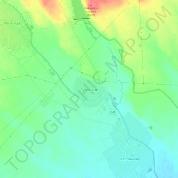
Name: Duvanlii topographic map, elevation, terrain.

Location: Duvanlii, Kaloianovo, Plovdiv, 4172, Bulgaria (42.35032 24.70020 42.39032 24.74020)

Average elevation: 236 m

Minimum elevation: 214 m

Maximum elevation: 278 m

Other topographic maps

Click on a map to view its topography, its elevation and its terrain.

Южен

Bulgaria > Plovdiv

Average elevation: 173 m

Източен

Bulgaria > Plovdiv

Average elevation: 159 m

Hisaria

Bulgaria > Plovdiv

Average elevation: 524 m

Южен

Bulgaria > Plovdiv

Average elevation: 173 m

Централен

Bulgaria > Plovdiv

Average elevation: 168 m

Gear up for your next adventure:

🧶550 Survival Paracord - Versatile utility cord for emergency repairs and rigging
🧥Fleece Jacket - Warm and lightweight jacket for layering
Camping Coffee Maker - Brew fresh coffee anywhere on the topographic map
🧴Sunscreen SPF - Broad-spectrum sunscreen for outdoor activities
🥾Hiking Shoes - Durable and comfortable shoes for trail hiking

As an Amazon Associate, this site earns from qualifying purchases at no extra cost to you.