Geolocate

Mina topographic map

Click on the map to display elevation.

About this map

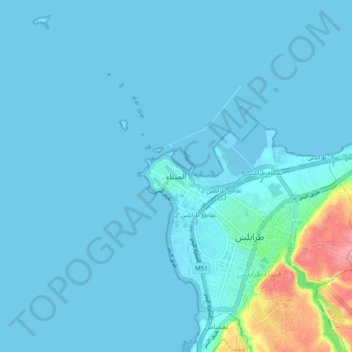
Name: Mina topographic map, elevation, terrain.

Location: Mina, El Mina, Tripoli District, North Governorate, 1301, Lebanon (34.41111 35.77458 34.49111 35.85458)

Average elevation: 10 m

Minimum elevation: -3 m

Maximum elevation: 106 m

Other topographic maps

Click on a map to view its topography, its elevation and its terrain.

Tripoli

Lebanon > North Governorate

The urban form of Mamluk Tripoli was dictated mainly by climate, site configuration, defense, and urban aesthetics. The layout of major thoroughfares was set according to prevailing winds and topography. The city had no fortifications, but heavy building construction characterized by compact urban forms,…

Average elevation: 42 m

Gear up for your next adventure:

🧼Travel Hand Sanitizer - Keep hands clean when water is scarce
🥾Mountain Hiking Shoes - Shoes with superior grip for mountainous terrain
🧰Emergency Multi-Tool - Compact multi-tool for outdoor survival
🥾Light Hiking Boots - Lightweight and comfortable boots for day hikes
🔦LED Headlamp - Hands-free lighting for early morning starts or late finishes

As an Amazon Associate, this site earns from qualifying purchases at no extra cost to you.