Geolocate

Capitol Heights topographic map

Click on the map to display elevation.

About this map
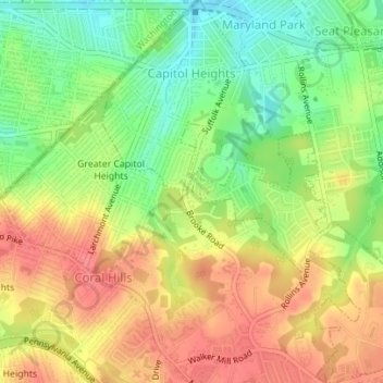
Name: Capitol Heights topographic map, elevation, terrain.

Location: Capitol Heights, Prince George's County, Maryland, United States (38.86303 -76.92160 38.89010 -76.89134)

Average elevation: 64 m

Minimum elevation: 29 m

Maximum elevation: 93 m

Other topographic maps

Click on a map to view its topography, its elevation and its terrain.

Gear up for your next adventure:

🧥Softshell Jacket - Windproof and breathable jacket for hiking
🥾Trail Hiking Socks - Comfortable socks to prevent blisters and fatigue
🚲MTB Frame Bag - Carry tools and maps directly on your bicycle frame
🥾Hiking Shorts - Breathable shorts suitable for summer hikes
🩹Moleskin Blister Pads - Direct protection for painful foot pressure points

As an Amazon Associate, this site earns from qualifying purchases at no extra cost to you.