Geolocate

Melanson topographic map

Click on the map to display elevation.

About this map
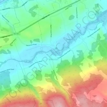
Name: Melanson topographic map, elevation, terrain.

Location: Melanson, Municipality of the County of Kings, Kings County, Nova Scotia, Canada (45.05696 -64.33428 45.09719 -64.29601)

Average elevation: 69 m

Minimum elevation: 0 m

Maximum elevation: 204 m

Nova Scotia trails, hiking, mountain biking, running and outdoor activities

Gear up for your next adventure:

🧭Orienteering Kit - Tools for map reading and navigation in the wild
🧣Merino Neck Gaiter - Protects against wind, sun, and cold at high altitudes
🥾Trail Running Shoes - Lightweight and durable shoes for trail running
🗺️Topographic Maps - Detailed maps to explore trails, mountains, and wilderness areas
💧Collapsible Water Bottle - Space-saving water bottle for outdoor activities

As an Amazon Associate, this site earns from qualifying purchases at no extra cost to you.