Geolocate

Galandhar topographic map

Click on the map to display elevation.

About this map

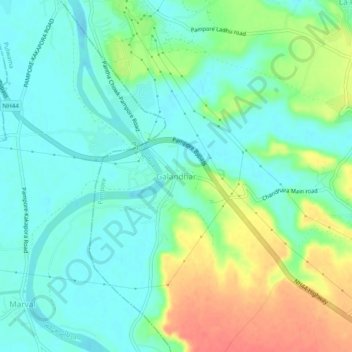
Name: Galandhar topographic map, elevation, terrain.

Location: Galandhar, Pampore, Pulwama, Jammu and Kashmir, 192121, India (33.97000 74.90510 34.01000 74.94510)

Average elevation: 1,601 m

Minimum elevation: 1,583 m

Maximum elevation: 1,638 m

Other topographic maps

Click on a map to view its topography, its elevation and its terrain.

Pampore

India > Jammu and Kashmir > Pampore

Average elevation: 2,015 m

Gear up for your next adventure:

🧥Fleece Jacket - Warm and lightweight jacket for layering
🚲Handlebar Phone Mount - View topographic-map.com live while cycling
🚲MTB Frame Bag - Carry tools and maps directly on your bicycle frame
💧Reusable Water Bottle - Durable water bottles for hydration on trails
🧦Hiking Socks - Moisture-wicking and comfortable socks for long hikes

As an Amazon Associate, this site earns from qualifying purchases at no extra cost to you.