Geolocate

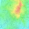
Durack topographic map

Click on the map to display elevation.

About this map

Name: Durack topographic map, elevation, terrain.

Location: Durack, City of Palmerston, Northern Territory, Australia (-12.48089 130.96186 -12.46426 130.98211)

Average elevation: 26 m

Minimum elevation: 8 m

Maximum elevation: 51 m

Other topographic maps

Click on a map to view its topography, its elevation and its terrain.
Palmerston

Australia > City of Palmerston

Average elevation: 25 m

Geoid Park

Australia > City of Palmerston > Palmerston

Average elevation: 26 m

Palmerston

Australia > City of Palmerston

Average elevation: 25 m

Geoid Park

Australia > City of Palmerston > Palmerston

Average elevation: 26 m

Gear up for your next adventure:

🔋Emergency Crank Radio - Weather alerts and power without needing batteries
💧Collapsible Water Bottle - Space-saving water bottle for outdoor activities
🚲Heavy Duty Bike Lock - Secure your bike at the trailhead or during stops
☕Camping Coffee Maker - Brew fresh coffee anywhere on the topographic map
🔥Emergency Fire Starter - Reliable ignition source for all weather conditions

As an Amazon Associate, this site earns from qualifying purchases at no extra cost to you.