Geolocate

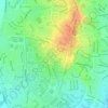
Palmerston topographic map

Click on the map to display elevation.

About this map

Name: Palmerston topographic map, elevation, terrain.

Location: Palmerston, City of Palmerston, Northern Territory, 0830, Australia (-12.51996 130.94441 -12.43996 131.02441)

Average elevation: 25 m

Minimum elevation: 0 m

Maximum elevation: 52 m

Other topographic maps

Click on a map to view its topography, its elevation and its terrain.

Zuccoli

Australia > City of Palmerston

Average elevation: 18 m

Palmerston City

Australia > City of Palmerston

Average elevation: 33 m

Gunn

Australia > City of Palmerston

Average elevation: 32 m

Gray

Australia > City of Palmerston > Palmerston

Average elevation: 31 m

Moulden

Australia > City of Palmerston

Average elevation: 19 m

Bakewell

Australia > City of Palmerston > Palmerston

Average elevation: 26 m

Durack

Australia > City of Palmerston

Average elevation: 26 m

Woodroffe

Australia > City of Palmerston

Average elevation: 24 m

Geoid Park

Australia > City of Palmerston > Palmerston

Average elevation: 26 m

Rosebery

Australia > City of Palmerston > Palmerston

Average elevation: 19 m

Geoid Park

Australia > City of Palmerston > Palmerston

Average elevation: 26 m

Gear up for your next adventure:

🧤Rechargeable Heated Gloves - Extreme warmth for Canadian winter expeditions
🧢Hiking Sun Hat - Wide-brimmed protection for exposed mountain ridges
🧭Orienteering Kit - Tools for map reading and navigation in the wild
🪑Ultralight Camping Stool - Compact seating for rest stops during long hikes
🎒Backpack Rain Cover - External shield to keep your entire pack dry

As an Amazon Associate, this site earns from qualifying purchases at no extra cost to you.