
Gool-Gulabgarh topographic map
Interactive map
Click on the map to display elevation.
About this map
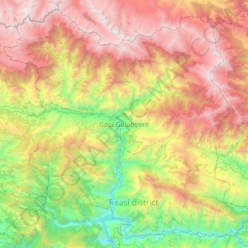
Name: Gool-Gulabgarh topographic map, elevation, terrain.
Location: Gool-Gulabgarh, Reasi district, Jammu-et-Cachemire, Inde (33.14614 74.60101 33.52569 75.09241)
Average elevation: 2,190 m
Minimum elevation: 398 m
Maximum elevation: 4,613 m
Other topographic maps
Click on a map to view its topography, its elevation and its terrain.
lhad
Inde > Jammu-et-Cachemire > Gool-Gulabgarh
lhad, Gool-Gulabgarh, Reasi district, Jammu-et-Cachemire, Inde
Average elevation: 1,841 m