Geolocate

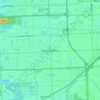
Cloud Forest topographic map

Click on the map to display elevation.

About this map

Name: Cloud Forest topographic map, elevation, terrain.

Location: Cloud Forest, Miami-Dade County, Florida, 33177, United States (25.59549 -80.40767 25.61549 -80.38767)

Average elevation: 6 m

Minimum elevation: 3 m

Maximum elevation: 7 m

Other topographic maps

Click on a map to view its topography, its elevation and its terrain.
Doral

United States > Florida > Miami-Dade County > Doral

Average elevation: 6 m

Gear up for your next adventure:

🧰Multitool Knife - Compact and versatile tool for outdoor use
☕Camping Coffee Maker - Brew fresh coffee anywhere on the topographic map
🧥Softshell Hiking Jacket - The perfect balance of wind protection and breathability
🥾Trekking Poles - Adjustable trekking poles to reduce knee stress and improve stability
🧥Thermal Layer - Insulating layer for cold outdoor conditions

As an Amazon Associate, this site earns from qualifying purchases at no extra cost to you.